Maps and spots
Layers you can turn on and off, filters that actually filter, and a heatmap weighted for recency so last April does not outshout last week.

Turn on what you need and nothing else
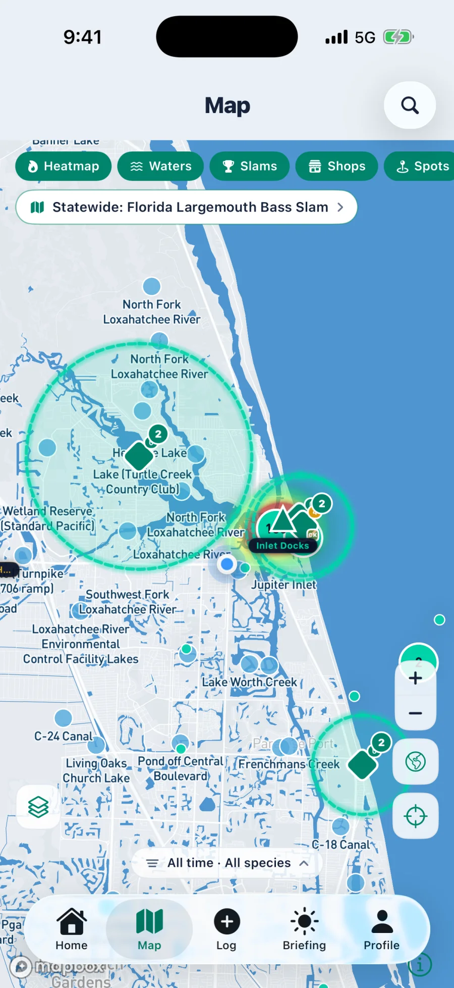
Heatmap, water bodies, Slams, shops, and spots each toggle independently, then depth, habitat, and wind stack underneath. Filter the whole thing by species and by time range from seven days out to all time.
- Catch heatmap weighted so recent activity reads hotter than old activity
- Species filter across everything catchable near you, one tap each
- Time range from seven days through ninety days to all time
- Water bodies, ramps, tackle shops, and active Slams as their own pin sets
What each layer is for
Catch heatmap
Real logged catches, recency weighted. Filter to one species and a tight time window and the pattern for right now jumps off the screen.
Water bodies
Named lakes, creeks, canals, rivers, and inlets with their own profile pages, proven species lists, and recent activity scores.
Active Slams
Geo fences drawn on the map with their radius visible, plus statewide Slams surfaced in a banner when one applies to your area.
Ramps and access
Boat ramps and access points so the plan includes how you get on the water, not just where you fish once you are there.
Your own spots
Drop a pin inside any water body and mark what it actually is. Twenty five kinds, from oyster bar and grass flat to bridge piling, dropoff ledge, laydown, jetty, wreck and stump field. A spot marked as a creek mouth means something the app can reason about later.
Private or public, per spot
Each spot you add carries its own visibility. Keep the one you found last spring to yourself and share the public jetty everybody already knows about. It is decided spot by spot, not with one switch across your whole account.
Rate what you fish
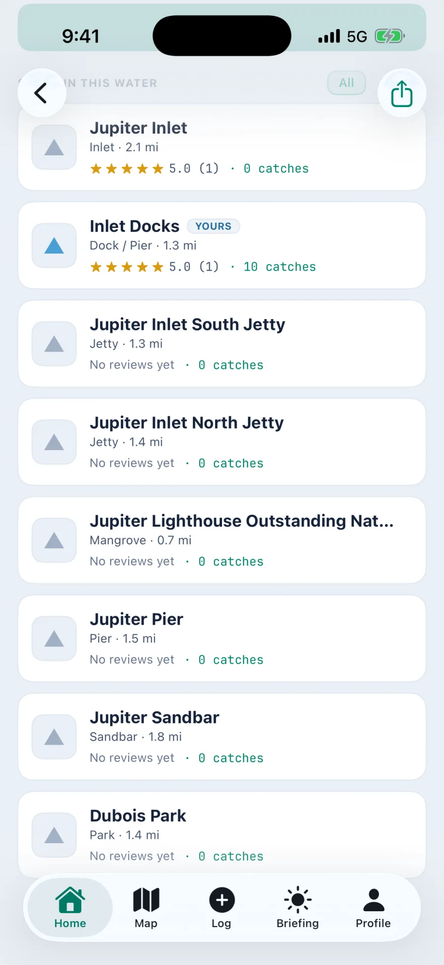
Public spots take a one to five rating from the anglers who fish them, with the average and the count both shown. Thirty ratings averaging a four is a very different proposition to a single five from whoever added it.
Tackle shops
Local shops pinned on the map. Real ones, including partners like Captain Kenny in Jupiter, not a scraped directory.
Depth and habitat
The bathymetry and habitat layers stack under everything else, so the heatmap sits on top of the bottom that explains it.
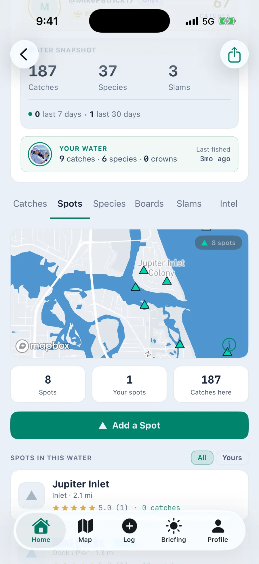
Open a water body and the spots are already in it
Every named water carries its own set of spots, each with a kind, a rating from the people who fish it, and the number of catches logged there. Add your own and decide on the spot whether anybody else sees it.
About maps and spots
Only when they chose to share exact coordinates. Catches marked private never appear, and catches shared with fuzzed location contribute to the general area without exposing a pin. Spot privacy is a per catch decision made by the angler who logged it.
Whoever you decide, spot by spot. Mark it private and it stays yours. Mark it public and it joins the water body page for everyone, where it can be rated.
Map tiles cache as you browse, so recently viewed areas remain usable with poor signal. Live layers like wind and radar need a connection to refresh.
Tomorrow morning starts tonight
Set your home water, pick a drive radius, and wake up to a plan.
Android coming soon
iPhone, iOS 17 or later. Setup takes about a minute.