Weather and wind
Wind direction decides which bank holds bait, which side of the inlet is fishable, and whether the run is worth the fuel. A single number cannot tell you that, so Cobia draws it.

A flow field over your own coastline
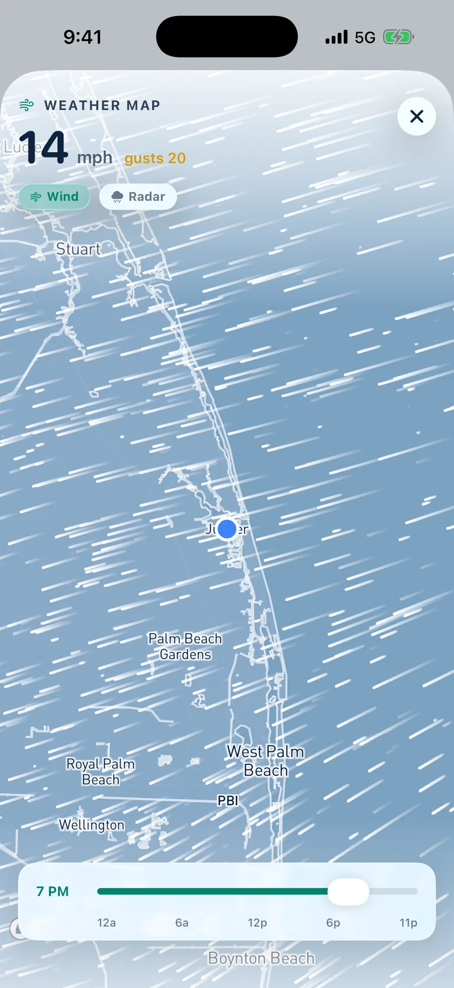
Thousands of particles trace the actual wind field across your local water, animated in real time. Scrub the timeline and watch the afternoon sea breeze fill in before you decide what time to launch.
- Animated particle field drawn over your water rather than a national map
- Hour scrubber across the full day so you can find the lull
- Radar layer on the same surface with one tap
- Sustained and gust shown together, because the gust is what ends the day
What the app watches, and why an angler cares
Direction and speed
An east wind pushes bait against the pilings on an incoming tide. A west wind flattens the surf and dirties the backcountry. Direction is shown as a compass letter, not just a degree.
Gust spread
Sustained twelve with gusts to eight is a different day from sustained twelve with gusts to twenty six. The spread is shown next to the sustained figure everywhere it appears.
Barometric pressure
Absolute millibars plus the trend. A falling glass ahead of a front is one of the most reliable bite triggers there is, and a hard high behind it is the opposite.
Cloud cover
Percentage cloud feeds the bite score directly. Heavy overcast extends the topwater window on the flats, and bluebird high sun pushes fish to shade and depth.
Wave height and period
One point three feet at three seconds is a chop you can fish. One point three at nine seconds is swell. Both are shown so the number means something.
Radar
Precipitation overlaid on the same map so you can see the cell coming across the lake before the sky tells you.
About weather and wind
Yes. The flow field renders wherever you are, inland lakes and rivers included. It is drawn from the same forecast grid rather than from coastal buoys only.
The scrubber covers the full current day hour by hour, and the briefing carries a seven day lookahead so you can plan the trip and then check the hour when the day arrives.
Tomorrow morning starts tonight
Set your home water, pick a drive radius, and wake up to a plan.
Android coming soon
iPhone, iOS 17 or later. Setup takes about a minute.