Water conditions
Water temperature is the single most predictive variable in fishing and the one most apps get lazy about. Cobia resolves it to the water you are standing on, not the nearest airport.

The reading comes from your water, not a regional average
Cobia keeps a registry of thousands of water stations across coastal and inland systems. A catch logged on a canal in Palm Beach County gets that canal reading, not a sea surface temperature from twelve miles offshore.
- 6,400 plus stations in the registry backing every location query
- Coastal and inland both covered, from NOAA tide gauges to USGS river gauges
- Time aware so a catch logged at dawn gets the dawn reading, not tonight number
- Unit correct throughout, which sounds obvious until you have seen it done wrong
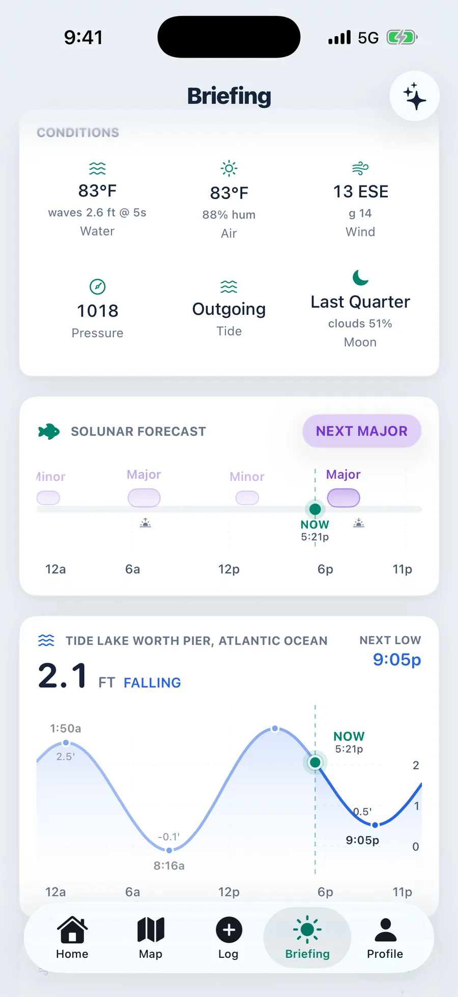
The readings that change how you fish
Water temperature
The number that decides whether a species is feeding, staging, or shut down. Shown on the conditions grid, in the briefing, and stamped onto every catch you log.
Wave height and period
Height alone is meaningless. One point three feet at three seconds is fishable chop. The same height at nine seconds is a swell that will move you off the spot.
Flow and stage
On rivers and canals, gauge height and discharge. A rising river after rain scatters fish. A falling one concentrates them on the outside bends.
Season derivation
Cobia derives the biological season from water temperature rather than the calendar, so a warm February on the Gulf coast reads as pre spawn instead of winter.
Stamped on your catches
Every catch you log carries the conditions at that moment. Over a season your own log becomes the most honest pattern data you own.
Pattern matching
Because conditions are stamped, the app can tell you what was happening the last time you had a day like this one on this water.
About water conditions
It resolves to the nearest gauge in the registry for that water type. On a coastal or gauged inland system it is close to instrument accuracy. On a small unmonitored pond it falls back to the nearest comparable station, and the app is transparent about which station it read.
Yes. The station registry covers thousands of USGS and NOAA gauges nationally. Coverage is deepest where gauge density is highest, which is most of the populated coast and major inland systems.
Tomorrow morning starts tonight
Set your home water, pick a drive radius, and wake up to a plan.
Android coming soon
iPhone, iOS 17 or later. Setup takes about a minute.